
Loowit Trail in a Day: August Mt. St. Helens Circumnavigation with the Volcanic 50k Race
Circumnavigating Mount Saint Helens on the Loowit Trail is a bucket list PNW adventure, and for good reason.
The more you dig into the history, geology, and impact of this mountain, the more awe you feel for her with each step. Although I’ve summited this peak over a half dozen times (all the winter route except for one summer summit), I'd been curious about completing the Loowit Trail in a day for years. But I was too lazy to plan out the logistics, specifically around finding running water sources at certain times of year. So, I tabled the idea… until a friend recommended Go Beyond Racing's Volcanic 50K.
The race was about $155 to register, and they handle all the logistics, including food and water at aid stations along the course, which meant I didn't have to think about the stuff I'd have to figure out on a DIY adventure! Well worth it, in my opinion. The race started at 7 a.m. and there were about 200 runners. I started and finished right in the middle of the pack, running with my friend Hannah. One day later, here's my report.
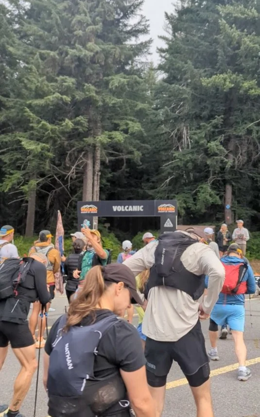
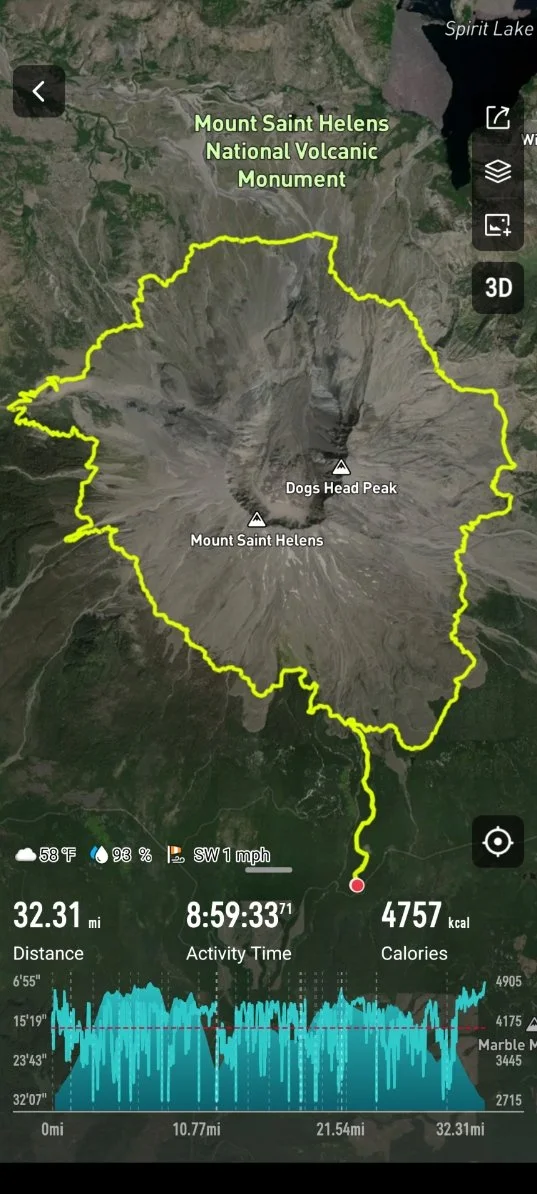
Recap of the Loowit Trail route: August 1, 2026
We went clockwise around the Loowit Trail, with the start line (and parking for the event) a couple miles south of the loop, at Marble Mountain SnoPark. From there, we ran up the shady, forested trail that parallels Swift Creek. (This is the same as the winter climbing route, so I was familiar with this part of the forest.) It's gentle to moderate uphill with some rocky footing, but the easiest trail section of the day (in my opinion).
Lucky and unlucky with the weather: Luckily, it was cooler than usual for August 1st, so I didn't have to worry about sun or heat. But it also meant a lot of the views were blocked. It was cloudy from the get-go, and we actually got drizzled on a lot throughout the day, which left me soaking wet at points in the second half. But it was welcome in the morning!
We turned left, or west, onto the Loowit Trail right about Chocolate Falls, and then we had a steady climb — I think the first four miles had about 2,000 feet of elevation gain (woof). After waking up at 4 a.m. and trying to motivate for a race, I was feeling pretty gross with poor digestion all day, mixed with intermittent light nausea. Although I knew I was well within my healthy and capable limits, I was still pretty grumpy for this long climb and feeling “meh.”
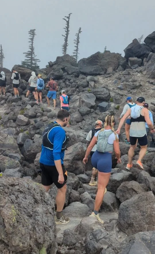
There were a couple boulder fields in the first few miles that slowed people down a lot, and you had to be careful not only to watch your own feet, but to watch all the people around you. It got a crowded at times, so you could be stuck in a line or clump of people and not move as fast as you wanted to.
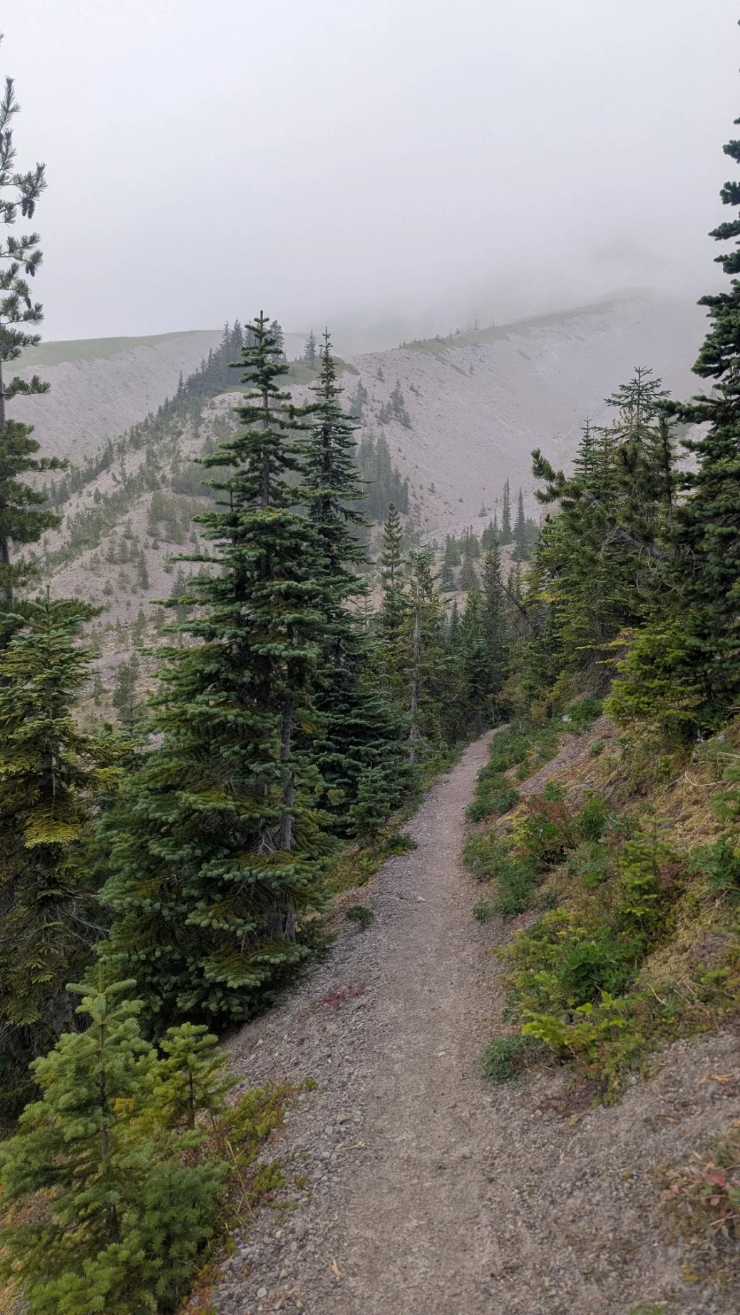
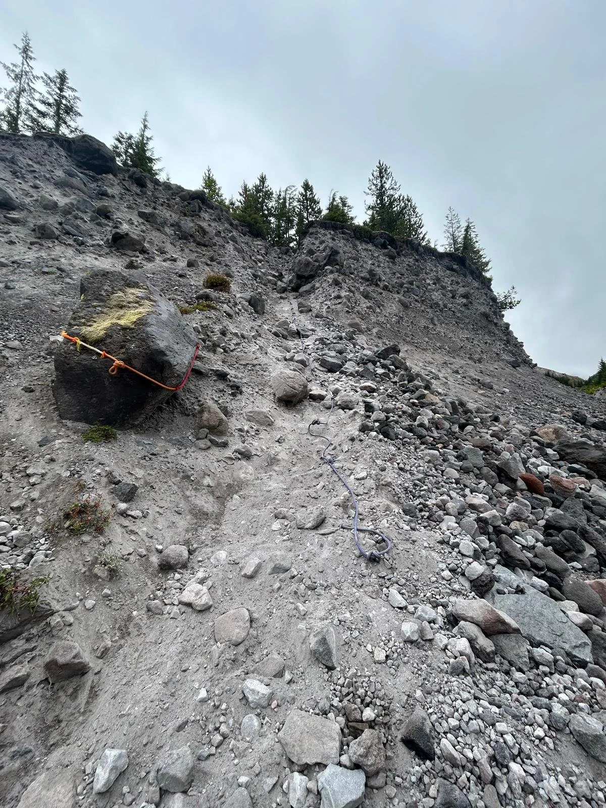
We ran along the southwest side of the Loowit Trail through some lovely runnable sections, and through a couple large gullies that had ropes fixed for us to help get down. Blue Lake Wash was steep enough that they asked everybody to descend the rope one at a time, so we wouldn't kick rocks onto each other. This created a bit of a holdup; I was probably standing there for less than 10 minutes, so I welcomed it as a break. (Totally understandable to have some waiting when there are 200 people trying to go down a technical trail!)
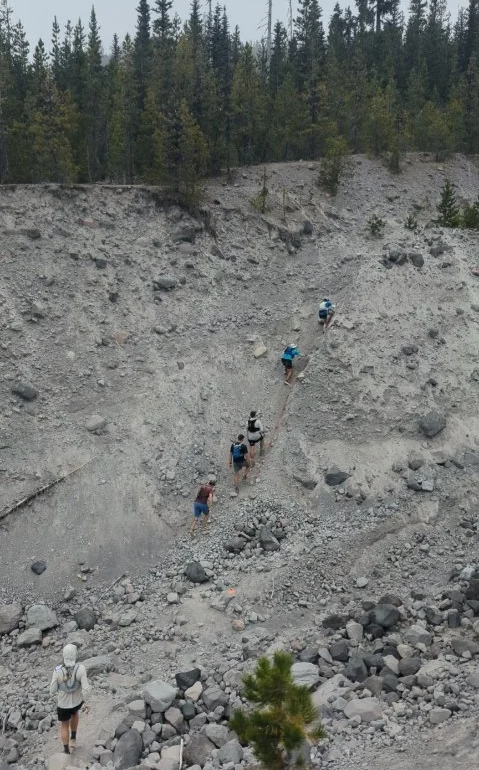
The ropes were awesome and helped us get down steadily. There was another rope on the other side of the gully to climb out of. It felt fun to use my arm muscles a bit, but I was surprised by how winded I was at the top of the roped sections from the effort.
Running through pretty subalpine areas, we still couldn't see any summit views, but we could see some of the mountain. We went through some forested bits to descend to the South Fork Toutle River and an aid station. If I were doing a DIY adventure, this would be a key water filter spot.
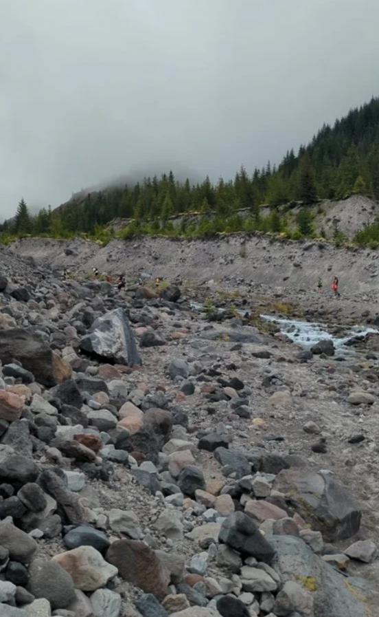
There was good current, but they marked out some boulders we could jump over so we didn't have to get our feet wet, which was very much appreciated.
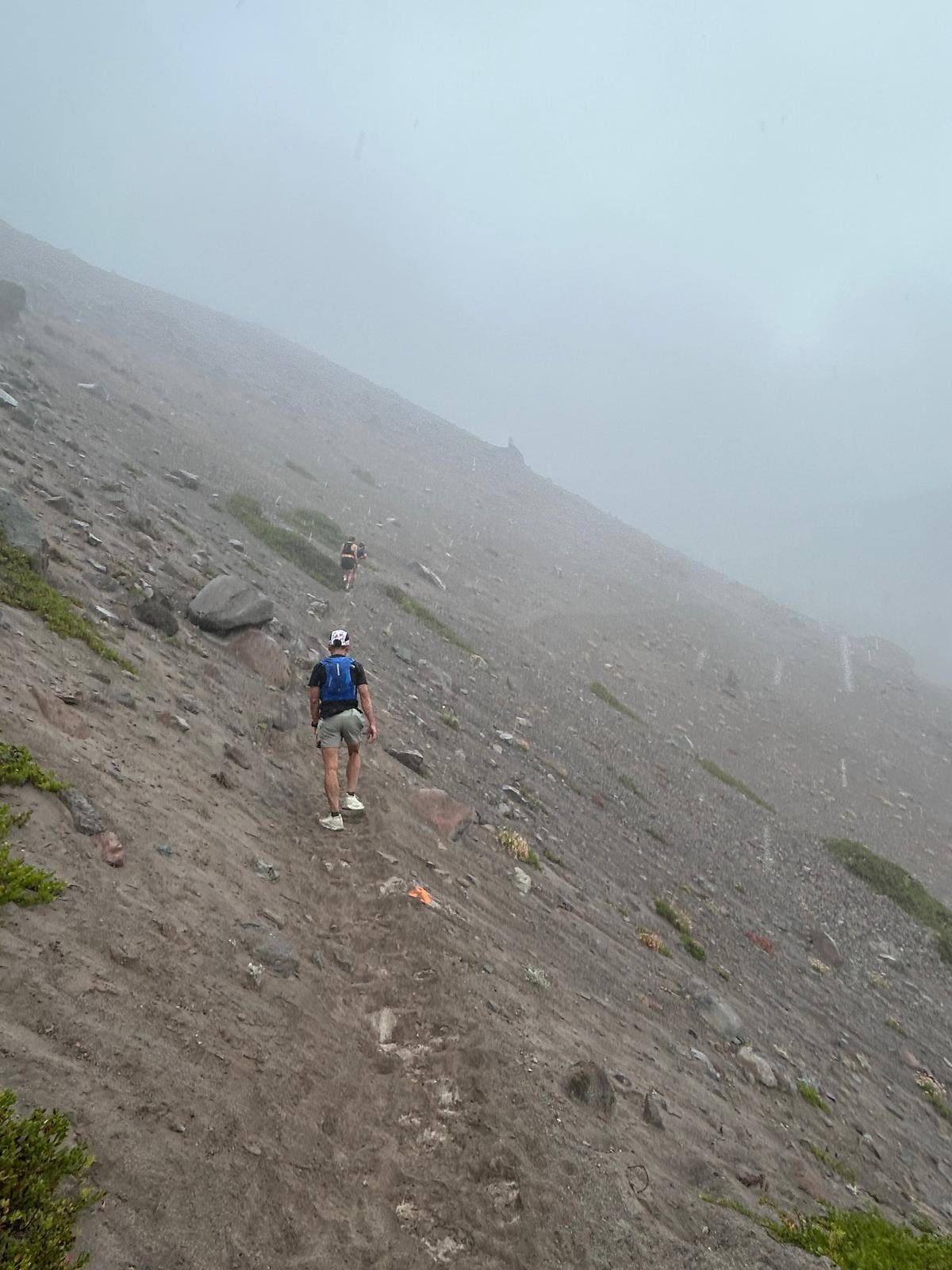
Then began the tough climb out of the Toutle Canyon. There were parts of this trail that were soft sand. It would've been super exposed in the sun, so I was grateful for the clouds again. This was one of those landscapes where you're just in awe of the ecosystems.
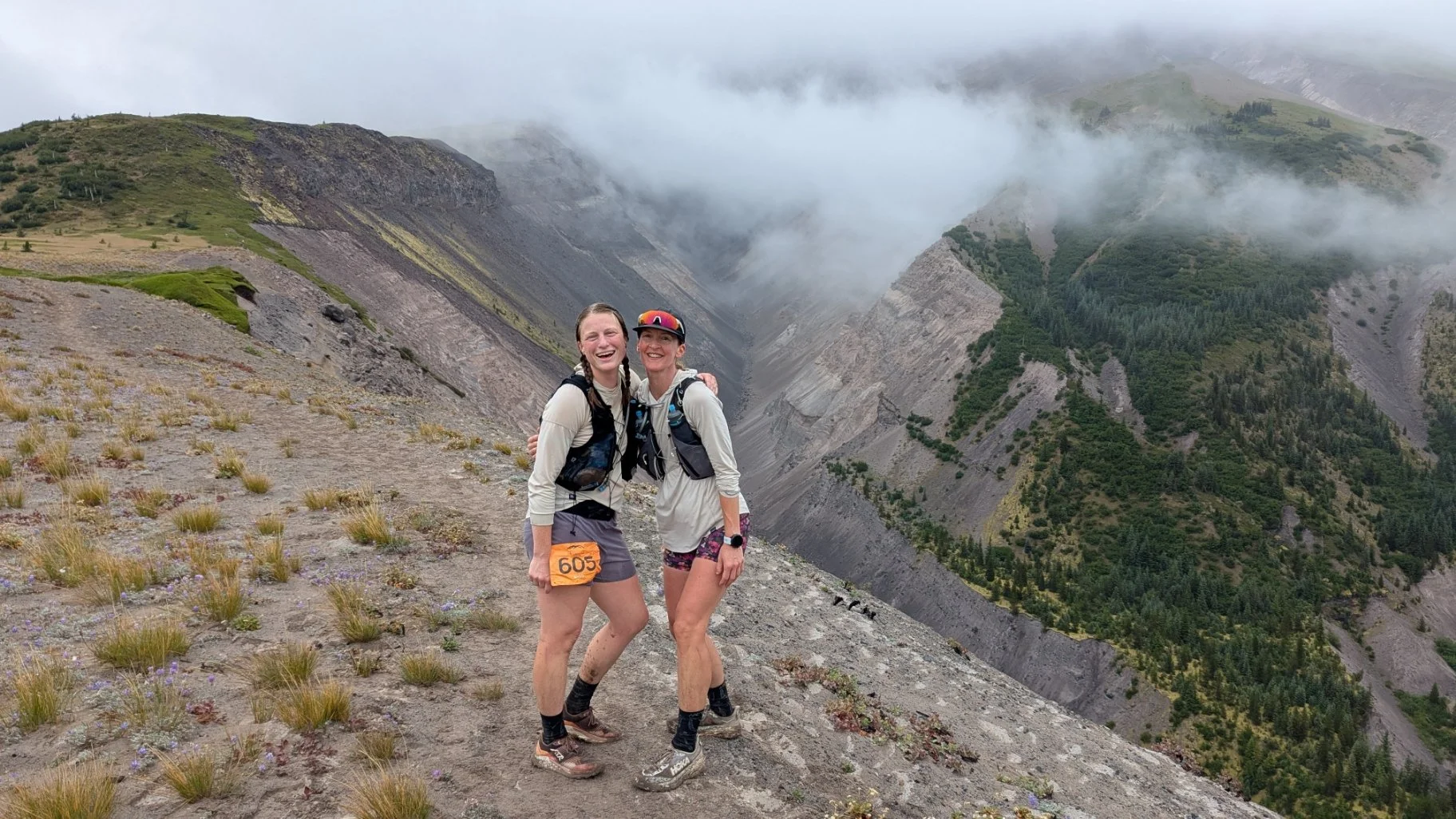
The crest of the climb gives you a beautiful reward, a deep look into the Toutle Canyon to your east and a beautiful meadow to your west. This was when our spirits perked up, and we stopped for some photos to appreciate the view.
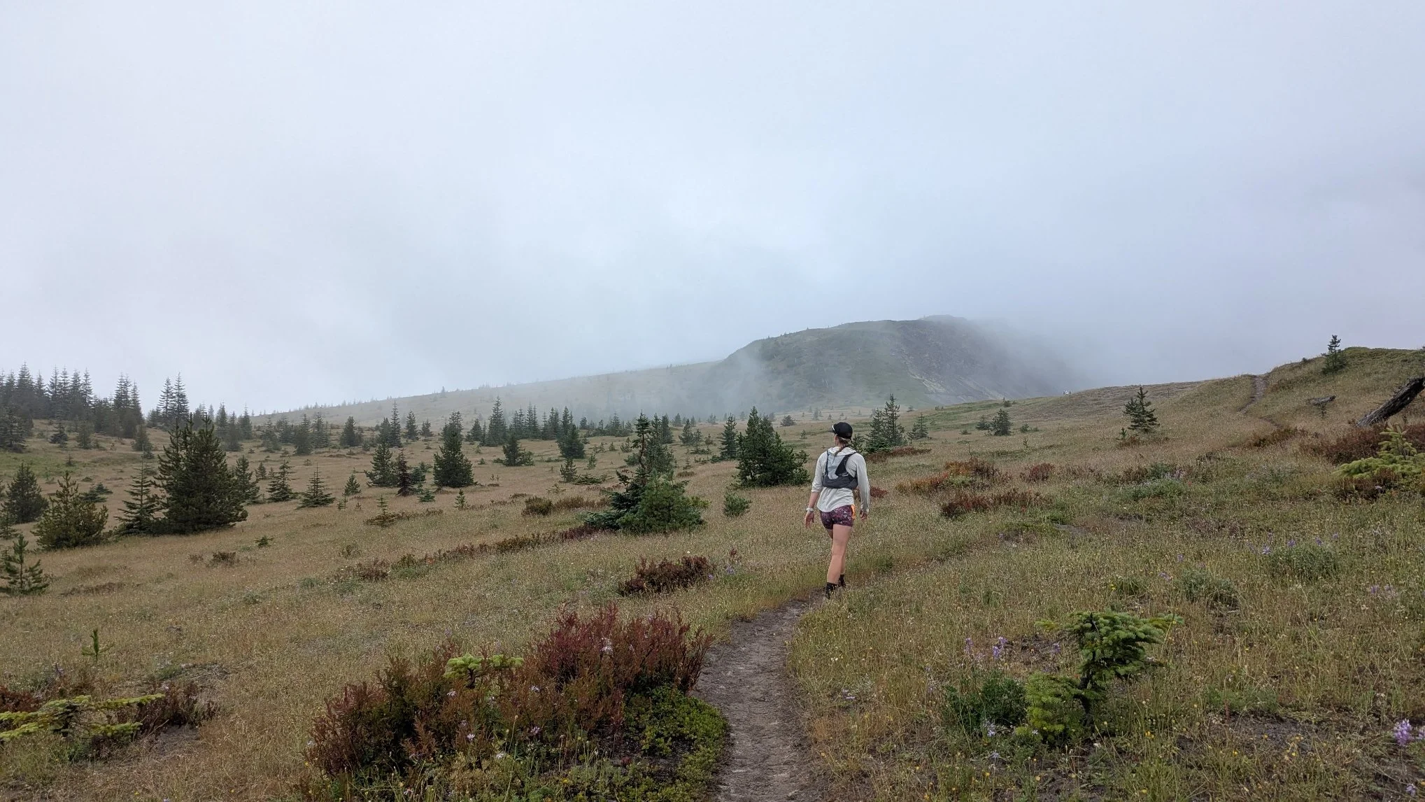
We also saw a lot of wildflowers here: tons of lupine, super stunted and close to the ground, which made it look like a big purple carpet. We saw a lot of paintbrush too, and enjoyed these colorful miles on the west and northwest side just before entering the blast zone.
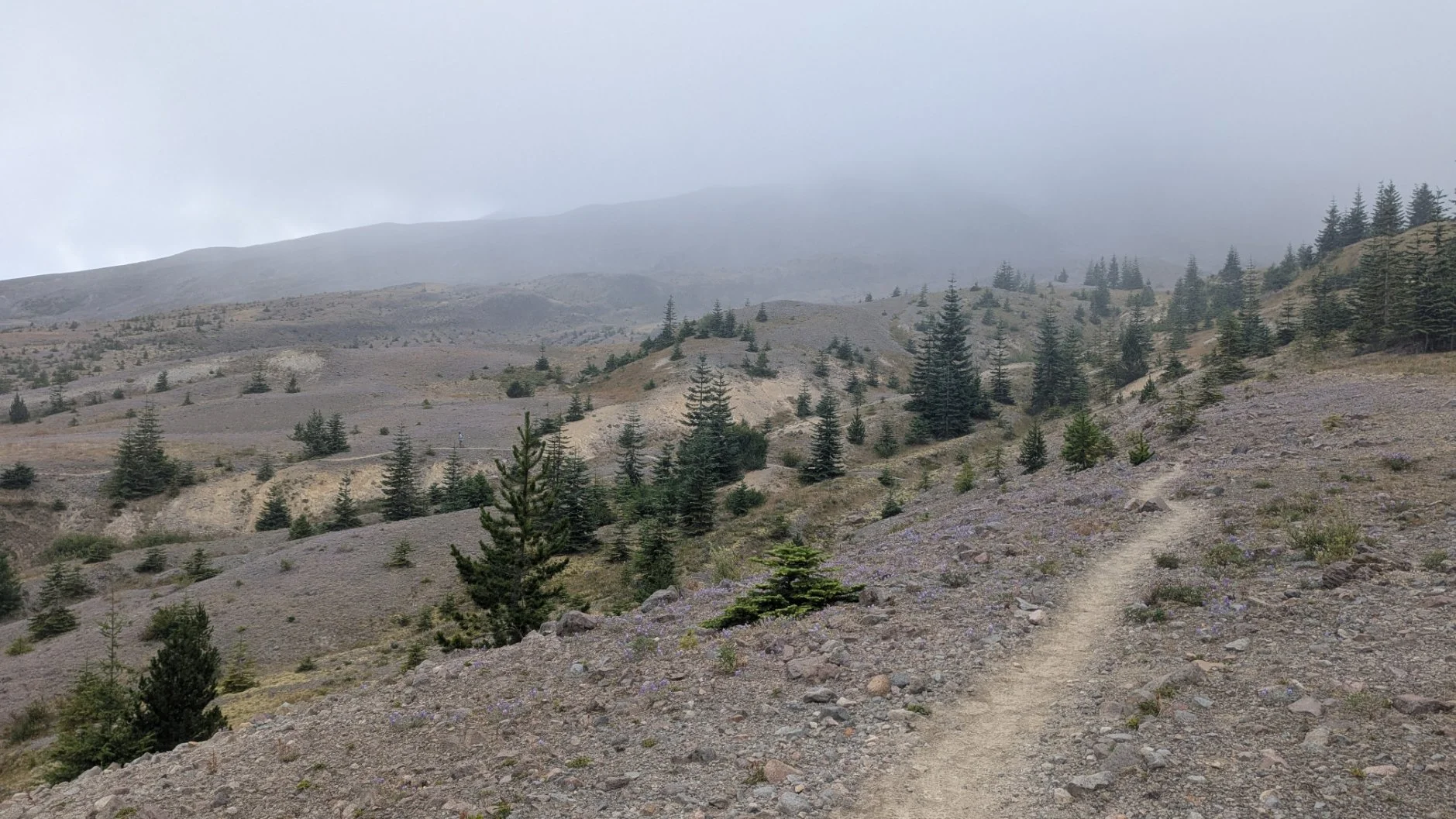
Entering the blast zone, the miles were relatively runnable. My friend Hannah used to work in Antarctica for research, and she said this landscape was reminiscent of parts of Antarctica, with the different colored rocks scattered everywhere.
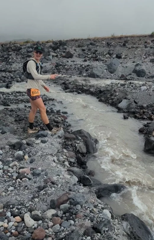
We were getting drizzled on a lot, but it felt like a cool, otherworldly experience. There were a couple creek crossings draining from the mountain (Crater Glacier runoff!) but we were able to take a couple big jumps across and, again, not get our feet wet (woohoo!).
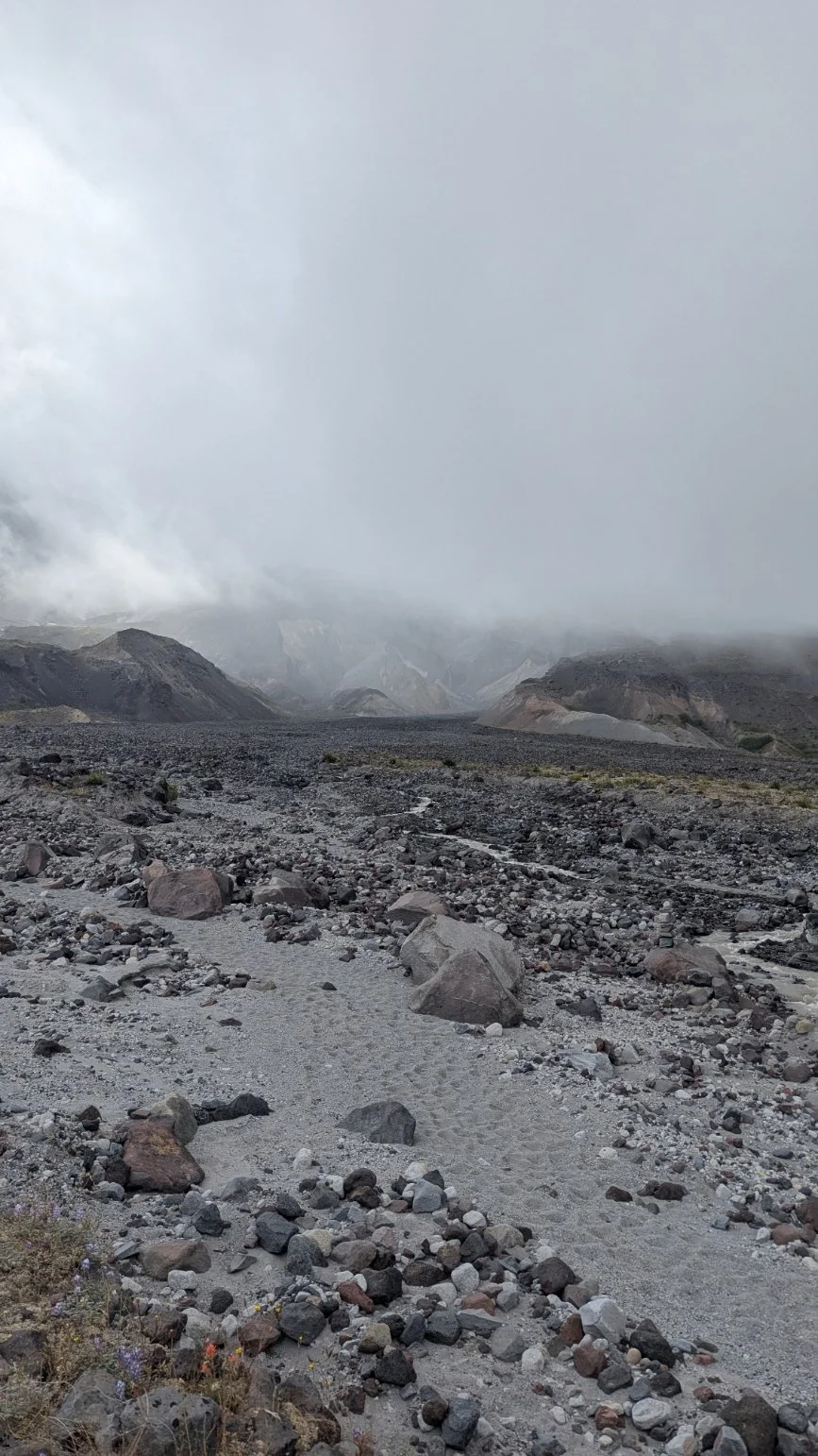
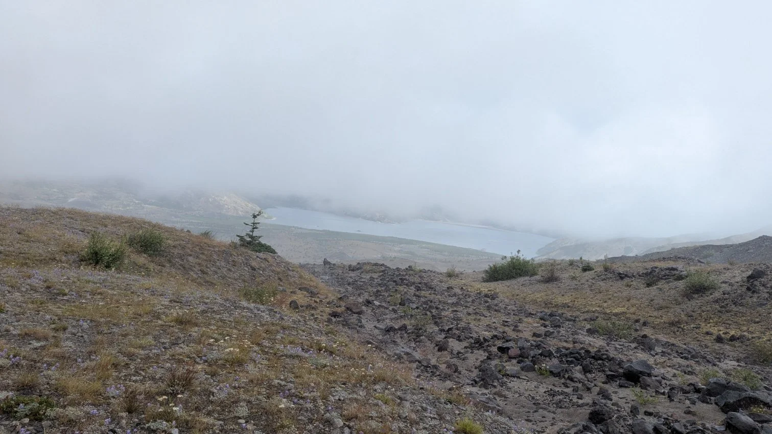
We passed a couple intersections with other trails you'd access from the Windy Ridge area, which was awesome since I'd never seen Spirit Lake in real life before. Despite it being cloudy and foggy and drizzly, we got glimpses of the lake, which was larger than I had imagined.
We continued on and eventually got to an astronaut-themed aid station at a spring coming out of the ground. Race volunteers were able to use the spring water to refill our bladders and add electrolytes to pitchers, which was really appreciated and put us in good spirits. Volunteers rock! A massive perk of running an official race over DIY.
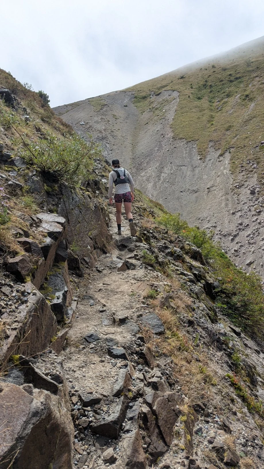
From there we made our way toward Windy Pass, which for me was reminiscent of the Alta Via 1 in the Italian Dolomites. IMO it wasn't nearly as hard as it looked, and when you crest the top you get sweeping views of the Plains of Abraham.
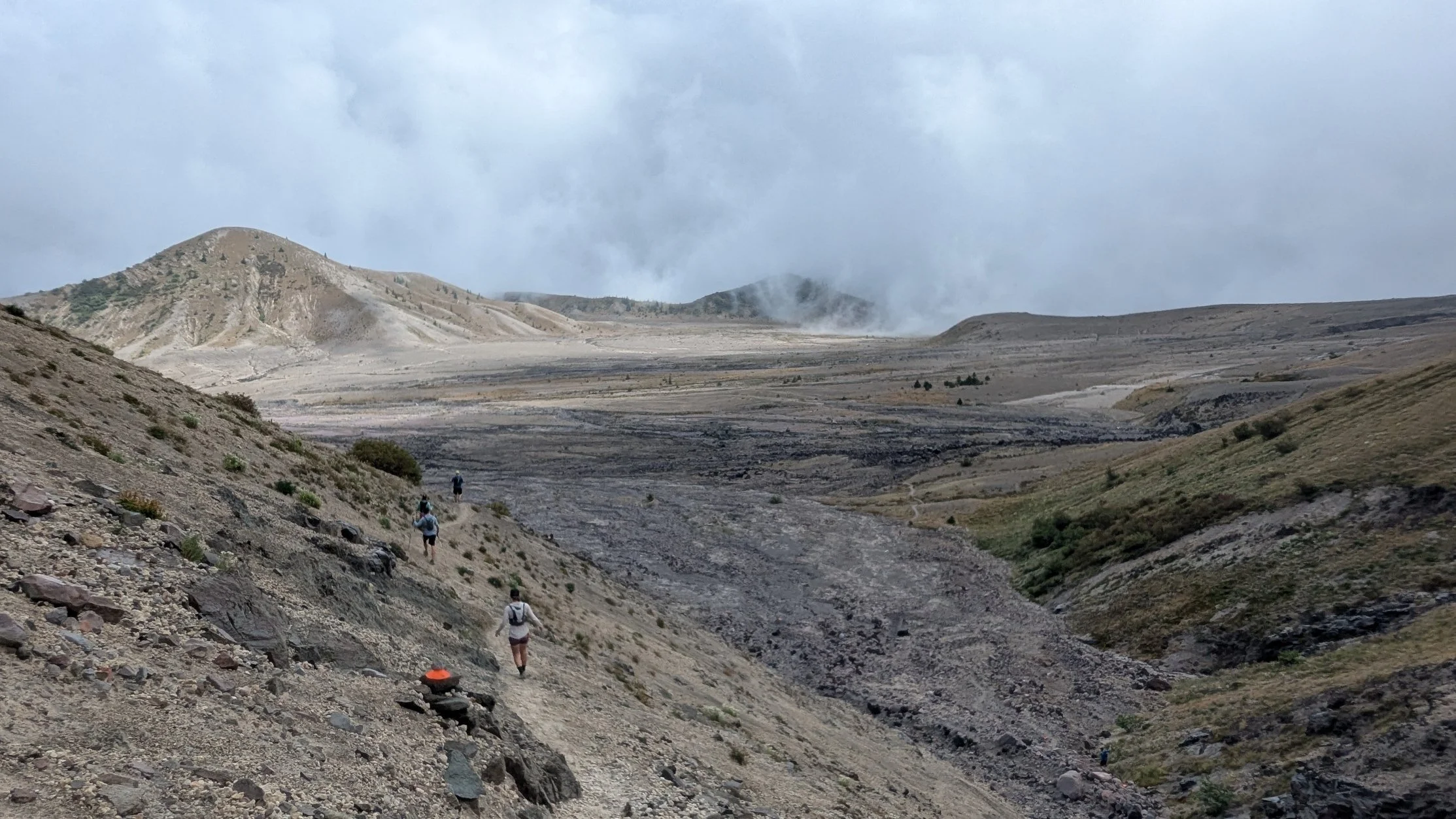
We saw three mountain goats above us as we crossed the pass, but I couldn't stare for that long, because the footing here was precarious and extremely steep, and I wanted to make sure I felt stable with every step down the other side of the pass.
Once we got down to the Plains of Abraham, it flattened out and had some really nice, easy running. We felt comfortable at 11-minute miles that felt like we could hold all day — but naturally, we wouldn't hold all day, because half of this volcano is unrunnable and covered with boulders and other brutal terrain. ;)
We still never saw the summit of the mountain, and most of the views were clouded in, but we were still able to appreciate it.
There was a final aid station near Ape Canyon. With eight miles to go from the last aid station to the finish, we filled up on water and trudged on. There were a lot of bouldery sections and gullies to go in and out of on this southeast side of the mountain.
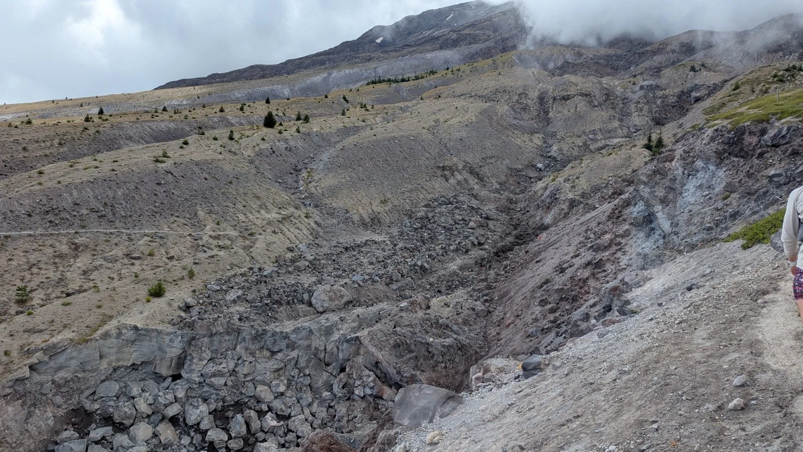
I deeply appreciated the dynamic ecosystems and how different the mountain is on all sides, so I stayed in good spirits, but we were definitely annoyed at how many rocks there were, and how they never seemed to end! There was always some sort of up or down; nothing was ever the same. I remember one gentler, lush area, that still had tons of shrubbery roots on the ground, so you had to be careful even just stepping over roots. No spacing out allowed on the Loowit!
In the last couple miles of the Loowit Trail before our turn back to the parking lot, there were more boulder fields, and we got stuck behind groups of people again. This was the same challenge as toward the beginning of the race, where you want to stay on the route but also go a comfortable speed for yourself, but it's just hard to pass, and a little awkward mid-race.
We took our time and eventually got back down to the forested area, made the turn south back toward Marble Mountain, and then we bombed downhill, feeling really strong even though we were exhausted from a whole day of very tough terrain. We had gas left in the tank since we’d hiked as much as we ran, so we were able to basically hit a six-minute mile pace on that final downhill toward the parking lot. We heard the crowd cheering for us before we could see them, and then we crossed the finish line at 9 hours, 30 minutes. (My friend Sarah Allaben set the women’s record in almost 4 hours faster than that, woah!)
The volunteers had burgers and snacks and drinks waiting for us, and tons of camping chairs for people to sit down and wait for their people to come through. The volunteers were so helpful, the directors were wonderful, and I'm really grateful I got to run the Loowit Trail without having to plan all of it myself.
I'm thankful I got a lot of training here in the Columbia River Gorge, but there are just some aspects of this you can't fully train for, and having a good mental attitude was absolutely crucial. I imagine that if you were doing this trail yourself, you'd need to be very careful with liquid capacity and snack capacity, and have some emergency gear. The race required us to have an emergency blanket, a windproof layer, at least 40oz of water, and a whistle. Of course, I'd bring more than that if I were going out in a non-race setting, but this made sense for the race (so did the requirement to have finished a 50k before — this isn’t a route to get complacent about).
I had two liters of water on me leaving every aid station and never ran out, but it wasn't that hot, and I also knew exactly when I’d have refills at aid stations ahead. With my stomach troubles, I mostly relied on race-provided Precision brand gels and chews.
I'd call this a “double black diamond” 50k, with incredible terrain you just won't find anywhere else. Mount Saint Helens is a place you can feel in your soul.
Stats:
Distance: 32.3 miles
Elevation: +7,215' / -7,215'
Elapsed time: 9:30:00 including stops
👋 More from me, Angie:
Check out my free weekly email/blog: BLOOD, SWEAT + FEAR. TONS of trail running musings on there including this series.
Connect with me on Instagram and LinkedIn — some video of this race is here!
I work on projects with brands and nonprofits to help more communities access transformative time in nature. See how to work together —>